


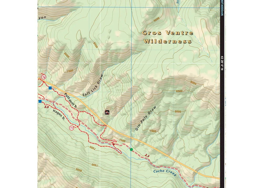
Adventure Maps, Inc. Grand Teton NP & Jackson Hole Trail Map
The Grand Teton NP & Jackson Hole map (2021) is a waterproof, topographic (lat/long, UTM grids) trail map that includes hiking and mountain biking route descriptions covering trails throughout Jackson Hole and Grand Teton National Park including, Bridger-Teton & Caribou-Targhee National Forests, and the Jedediah Smith and Gros Ventre Wilderness areas. Huge mountains, wide open vistas, clear mountain streams and lakes as well as plentiful wildlife are the draw to this very popular area.
Details
- Jackson Hole has something for everyone from easy, well marked trails to remote locations accessible only by long hikes or rides. Mountain bikers, hikers and equestrians will find hundreds of miles of trails on this map suitable for a wide range of skill and fitness levels.
- In addition, the ride and hike descriptions highlight some of the best trails plus popular road bike rides as well.
- Equestrian riders will also find this map useful as it shows all streams, lakes, roads, and land ownership boundaries.
- These printed maps come with a free digital copy (arriving with your map) for use on smart phones and tablets. Use the digital map to gps navigate out on the trails (no cell service needed once map is downloaded).
Specifications
- You will find route descriptions for 17 of the best mountain bike trails, 4 road bike rides, and 9 hiking trails.
- On this map are blowups of Grand Teton, Teton Pass, Munger Mountain, and Snow King, Cache Creek & Game Creek.
- Use the printed Waterproof/Tear Resistant map for planning, as a backup in case your phone ends up in a creek, to cover your head in a rain storm or for good old fashioned navigating.
Part Number: 656468001457

")


")

")


